

Portfolio
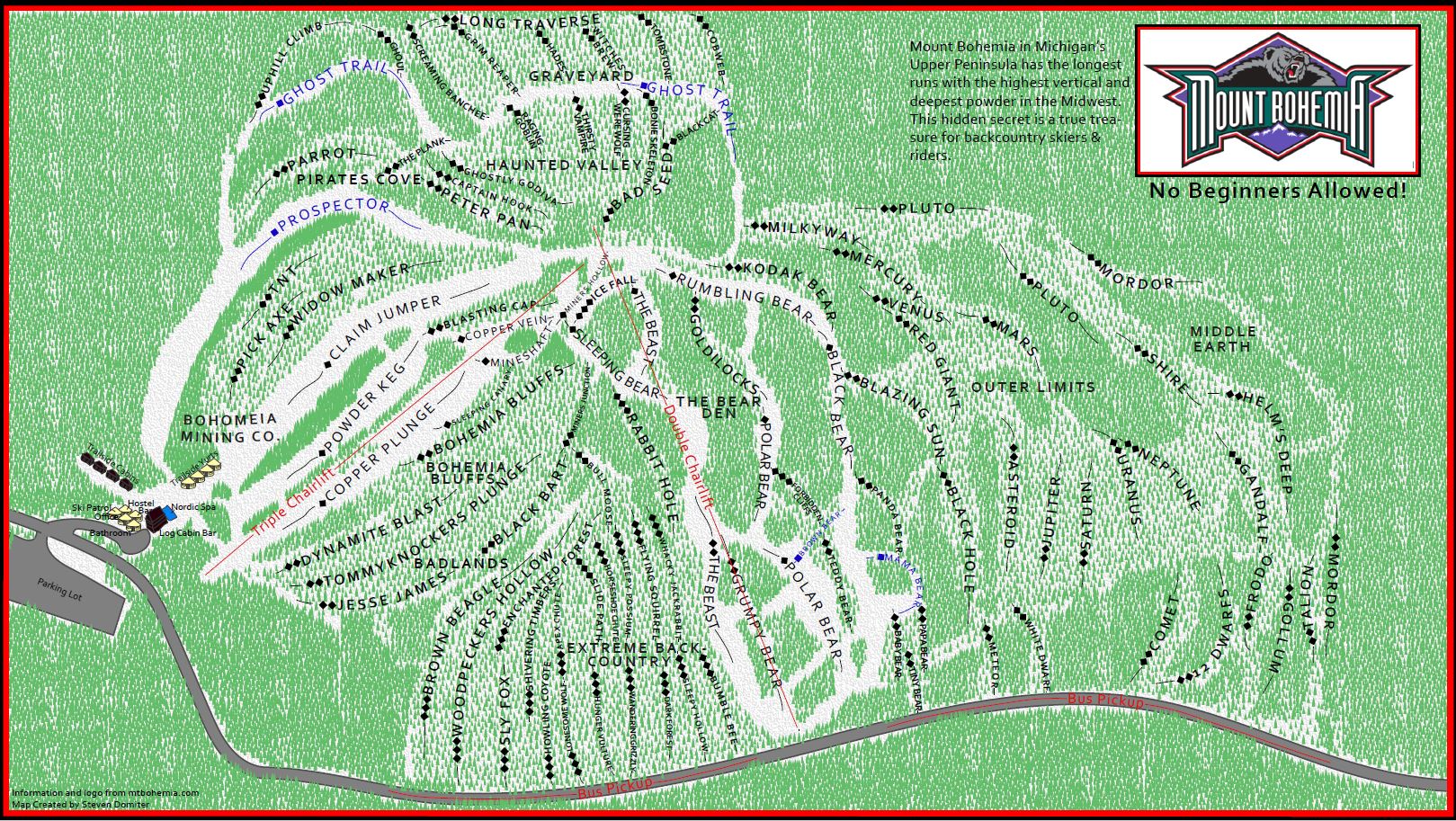
Mount Bohemia Trail map
Mount Bohemia is a backcountry style ski resort in the Uper Peninsula of Michigan. After visiting many times, I noticed that none of there trail maps effectively represent the mountain, so I decided to give it a try myslef. This trail map follows a typical ski map style and represnts all mountain features. The map is a top down view and the tree density is intended to correlate to actual tree density on the mountain.
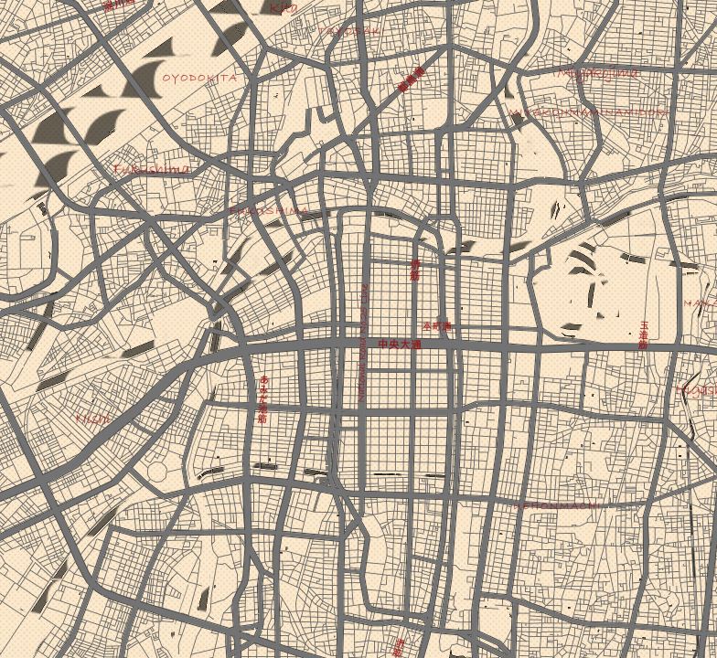
Ancient Japanese Style
This interactive world map is themed in an ancient Japanese style. Motivation was drawn from ancient hand drawn maps and classic Japanese art styles. The map is intended to look hand drawn on thick paper. Custom textures where used for water, mountains, and forests to contribute to the hand drawn style. Custom icons where created to detail many historical locations throughout Japan and further benefits the map themes.
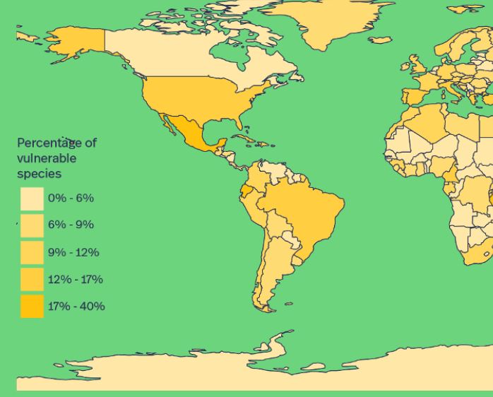
Vulnerable World
“Vulnerable world” is a storyboard assignment detailing the loss of biodiversity on a world scale. Through a series of maps, graphs, and images a story is told that expresses the severity of the extinction crisis. In the story Mexico is used as a poor example of species protections while Canada is used as a good example. The story calls to action all countries of the world to put in heavy environmental protections like Canada.
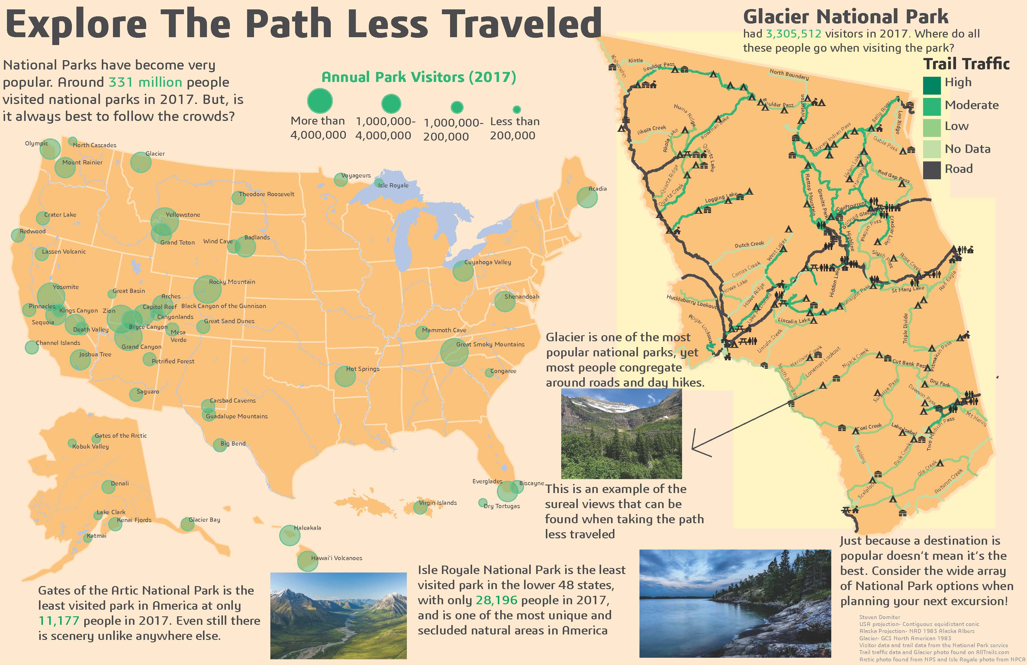
Explore the Path Less Traveled
This informational map urges the reader to visit National Parks that are not as popular. One map compares the yearly visitors of each American National Park. The other map takes a closer look at Glacier National Park and show how popular each specific trail is.
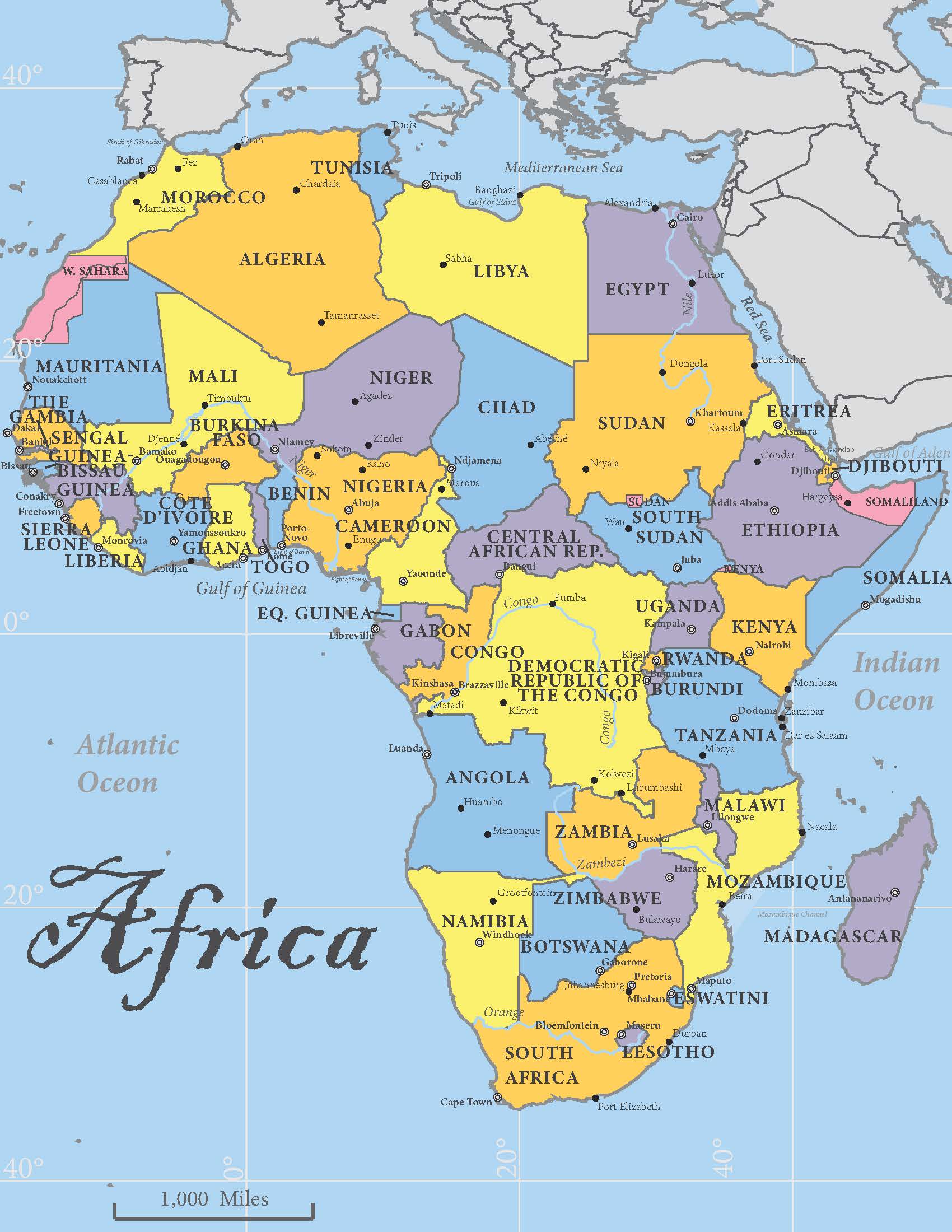
Africa
A simple map of Africa. A classic map style was used. Capitals, major cities and water features are all included.
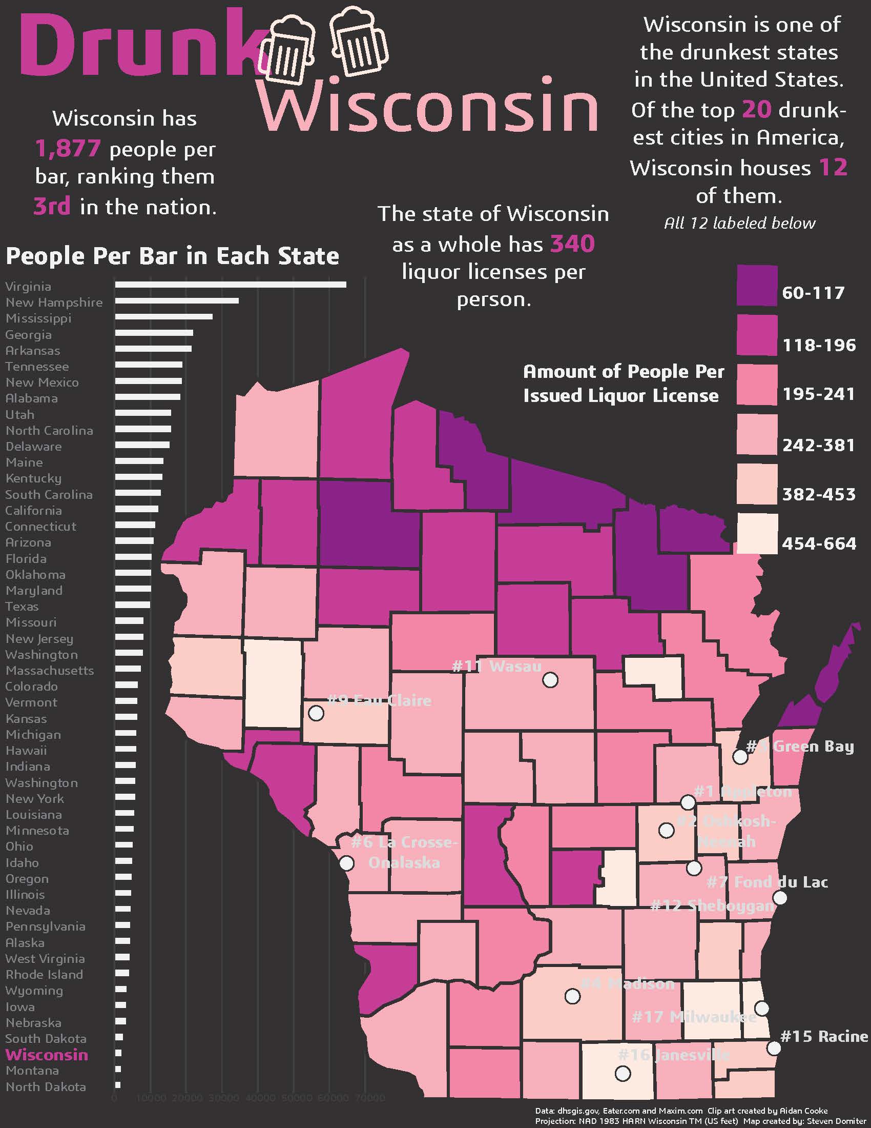
Drunk Wisconsin
This is a chloropleth map camparing the counties of Wiscosnin based on how many bars they have. There is also a chart comparing Wisconsin to other states.